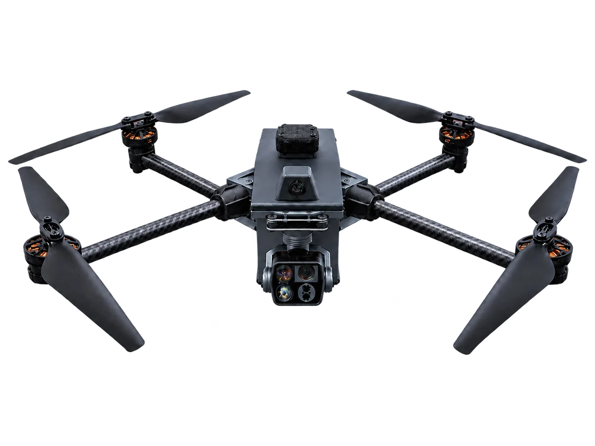
15″ ISR Drone
The PEKKLA 15-inch ISR drone is a foldable unmanned aerial vehicle for intelligence, surveillance and reconnaissance (ISR) and civilian aerial observation. It supports autonomous missions with daylight, night or thermal camera options, a maximum payload of 1 kg and flight duration of up to 75 minutes.
- Max payload
- 1 kg
- Flight duration
- up to 75 min
- Control link
- up to 40 km
Specifications
| Size | 15″ |
|---|---|
| Weight without battery | 1.4 kg |
| Max payload | 1 kg |
| Flight duration | Up to 75 min |
| Control link range | Up to 40 km; can be increased |
| Camera types | Daylight / Night / Thermal; optional image recognition |
| Wind resistance | Up to 18 m/s |
| Navigation | Jamming resistance and navigation in GNSS-denied areas |
| Flight capabilities | Autonomous missions, obstacle avoidance and geofencing |
| Optical stabilisation | Up to 1 km |
| Positioning | Camera-based coordinate determination |
Figures are indicative and depend on conditions and equipment configuration.
A camera platform for aerial observation
Foldable arms make the 1.4 kg airframe easier to transport; this weight excludes the battery. Camera options cover daylight, night and thermal observation, with optional image recognition. Obstacle avoidance, geofencing and camera-based coordinate determination are among the platform’s listed capabilities.
Choosing between the 15-inch and 22-inch platforms
The 15-inch drone is the lighter observation platform. For a larger payload or a communications relay, compare the 22-inch multi-purpose UAV, which has a maximum payload of 10 kg. Discuss the camera, link and ground control station together when specifying your system.
Configuration questions
Does the 75-minute flight duration apply with every payload?
No single endurance figure describes every configuration. Up to 75 minutes is the stated flight duration; battery, payload, weather and flight profile affect the result. Ask for the expected endurance of your chosen camera and battery configuration.
Can it operate without satellite positioning?
The catalogue lists navigation in GNSS-denied areas, optical stabilisation and camera-based coordinate determination. Ask PEKKLA to confirm the navigation equipment and operating conditions for your application.
Discuss your requirements
Contact our team for product information, configuration options or a demonstration.
Contact the team